This thesis is a culmination of my journey of discovering and uncovering a story of the underrepresented community.
The question that drove my thesis journey to where it is today is "how to represent the underrepresented?" or "how to create images of underrepresented places". Throughout my process, I attempted to answer this question through a series of experiments that utilized existing images to develop non-existent images that tell similar narratives and represent that same identity from a different angle.
My fascination with the underrepresented areas stems from my curiosity about informal neighborhoods in Cairo, Egypt. Every summer, we drive on the highway and find ourselves surrounded by elevations of red brick, also known as the Red City. They look like buildings under construction, yet they are fully habitable. How and why do these exist, and how do those communities live, and what do those communities look like?
Unfortunately, informal neighborhoods don't hold the best reputation among the people of Egypt for their aesthetics and the lifestyle they support. Not to mention that the Egyptian informal life has minimal coverage in Egypt's media and online.
Allow me to walk you though my board...
[At the very beginning of the board]
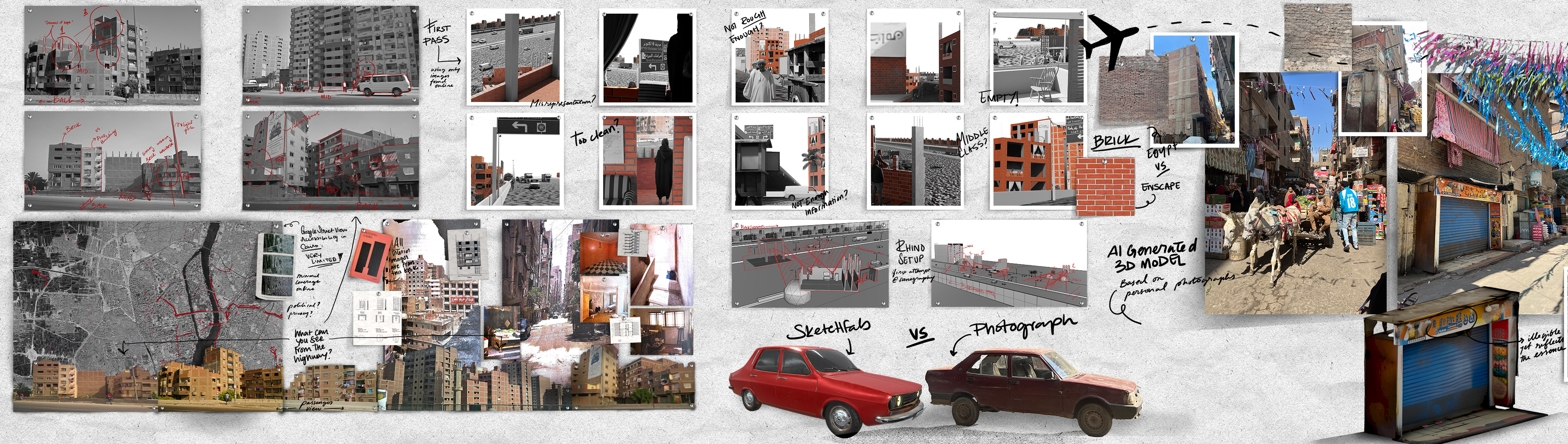
Google Street View is quite limited as it only covers a small portion of the whole country. And what you can access from Google Street View is only through the highway, which doesn't differ much from what I typically experience driving by the highway myself. And the question becomes: What can be seen and experienced beyond the highway, the one architectural element that separates these neighborhoods from the eyes of the world?
As I mentioned earlier, I searched for existing images of these informal neighborhoods to develop non-existent images that help fill in the gap and represent the underrepresented or the misrepresented. With so many highway views and limited interior representation, there was only so much I could work with, but I gave it a shot anyway.
...
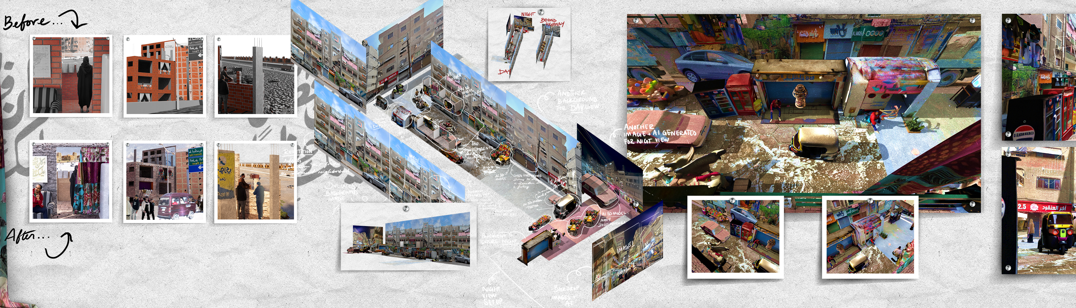
[Where you see 2 rows of 5 square, black and white-ish images]
Here's my first pass at representing the underrepresented. It was a learning curve, to say the least. Unfortunately, I might have added to the misrepresentation rather than the opposite. Because I primarily used Enscape to render, it came off as too clean, polished, and empty :/
...
[Look for the airplane icon]
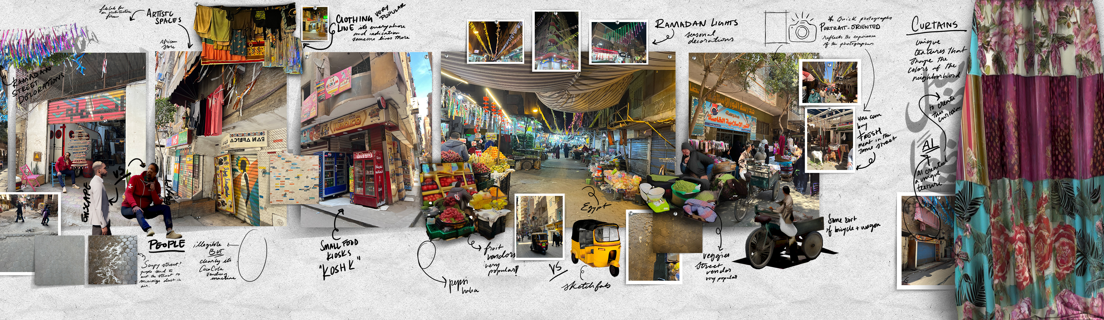
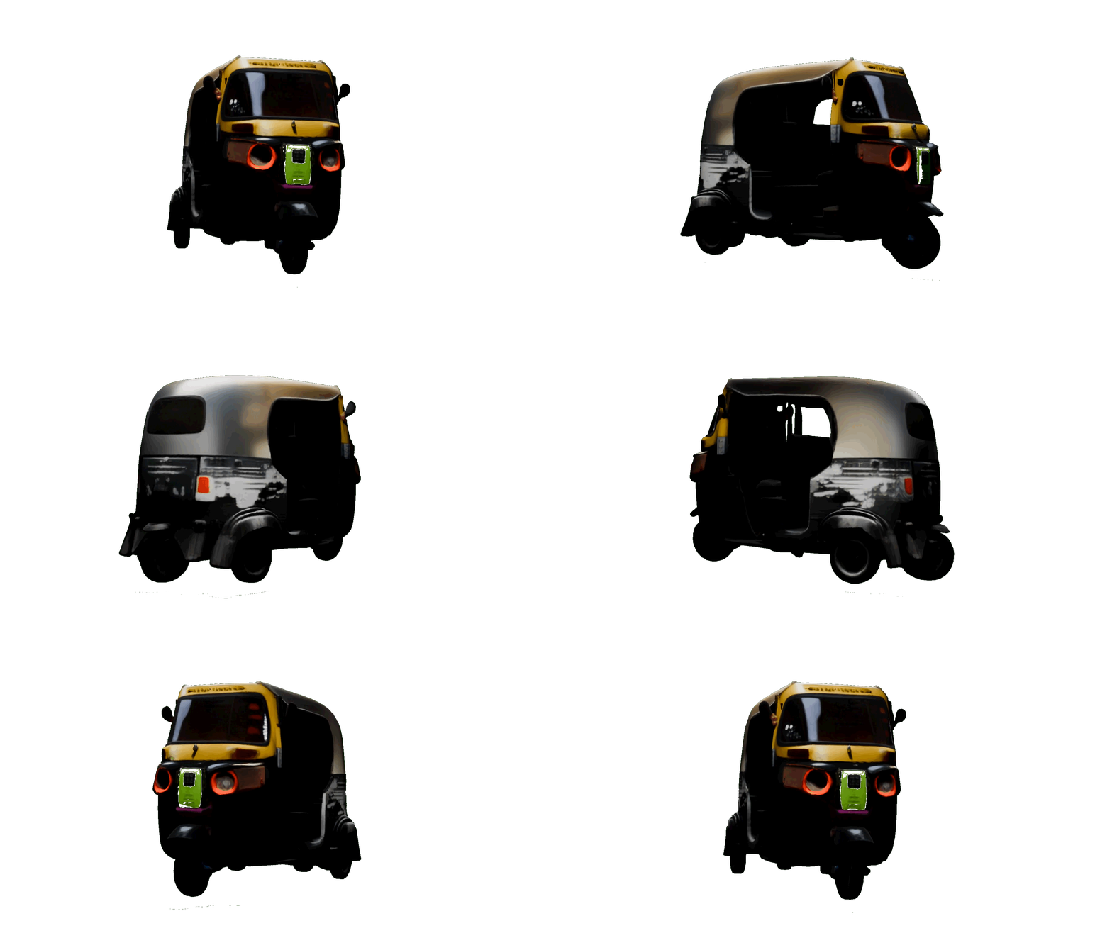
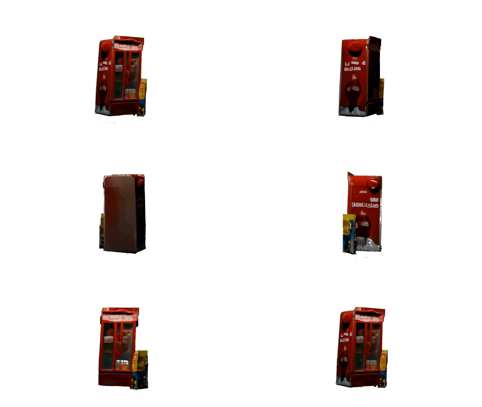
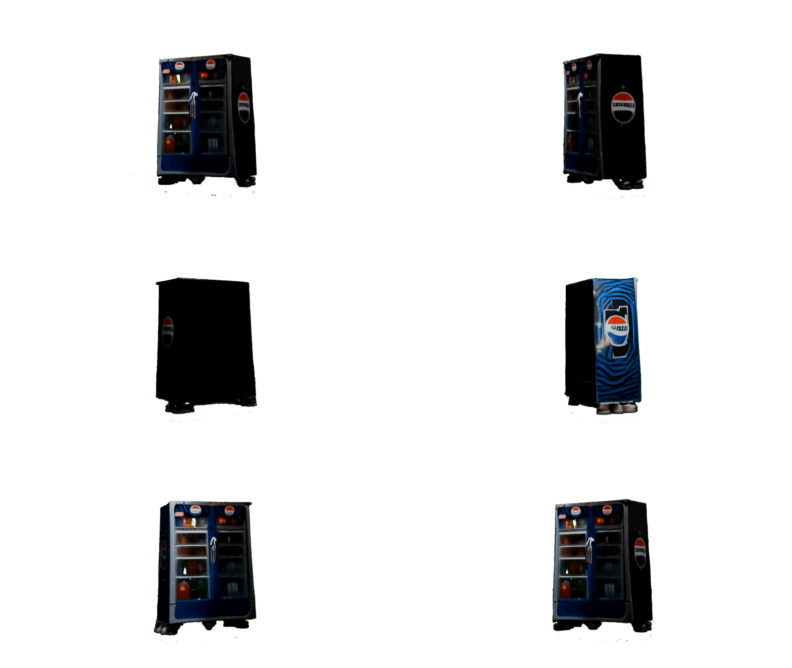
I found the available information limited, so I traveled to Egypt to gather more information firsthand, as you can see here. I went to Ard El-Liwa, a very well-known informal neighborhood. You would think that now I have all the information I need to know everything about this neighborhood. But in reality, even being there in person, my photographs are very limited. For instance, the verticality of the image reflects the quick manner in which I took the photos, which can leave a lot of information out. Another thing to keep in mind is the fact that I am considered a foreigner in the neighborhood, and having a visible camera capturing everything can look intimidating to the locals. Keeping that in mind, the speed at which I took the photos might have also left a lot of information out. Nonetheless, I was able to gather lots of textures and elements significant to the formation of this neighborhood's identity: the vending machines out and about, the toktok (the black and yellow tricycle-looking vehicle), the fruit and vegetable vendors, storefronts, and the random animals used for transportation (the donkey I captured).
I also want to point out the way this information was collaged. It seems hectic and overwhelming. This collage right here (from the airplane icon all the way to the curtain) depicts the experience I had walking the streets of Ard El-Liwa.
...
[Beyond the curtain]
This is where the fun begins because that is where AI becomes my best friend. Let me explain....
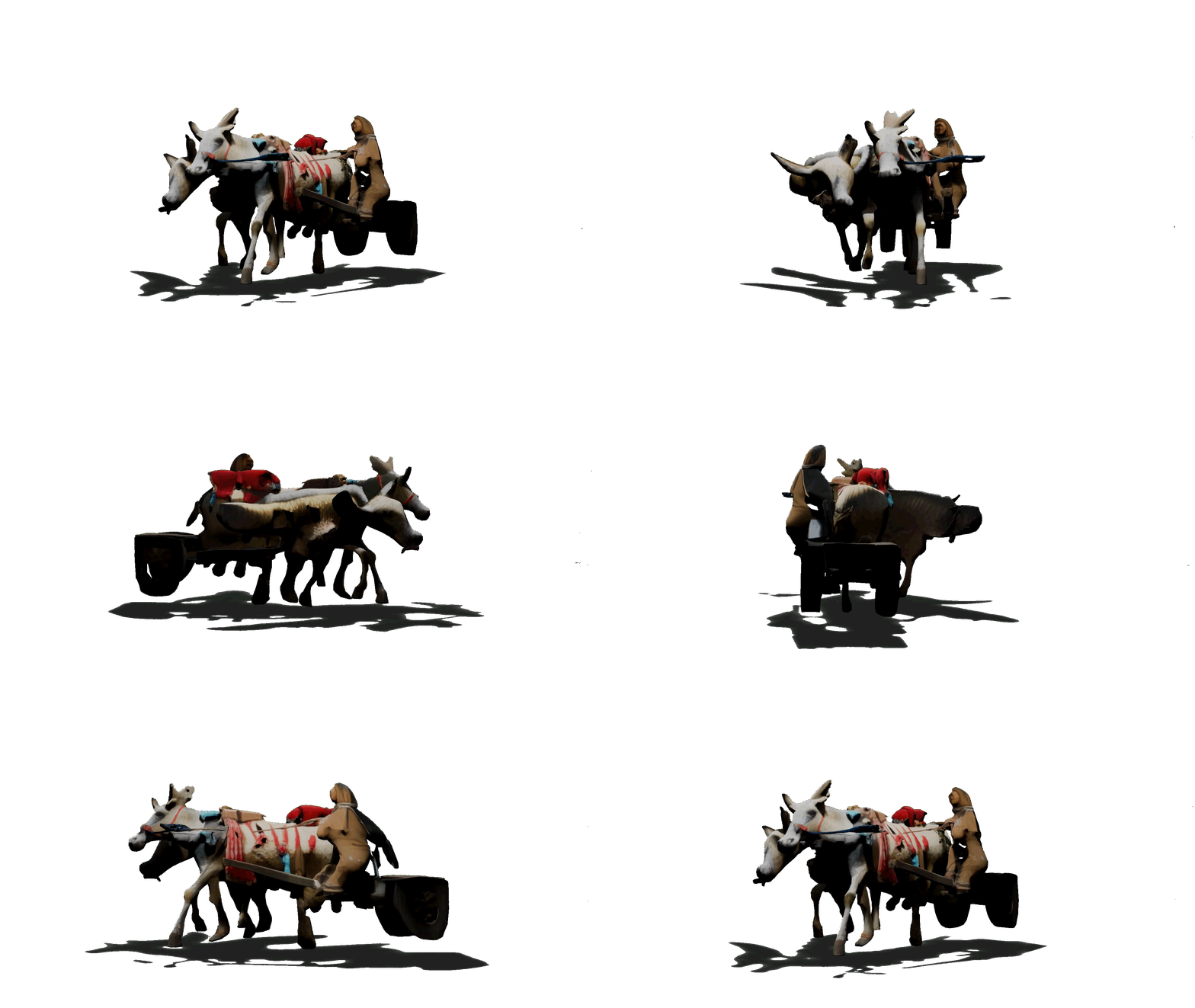
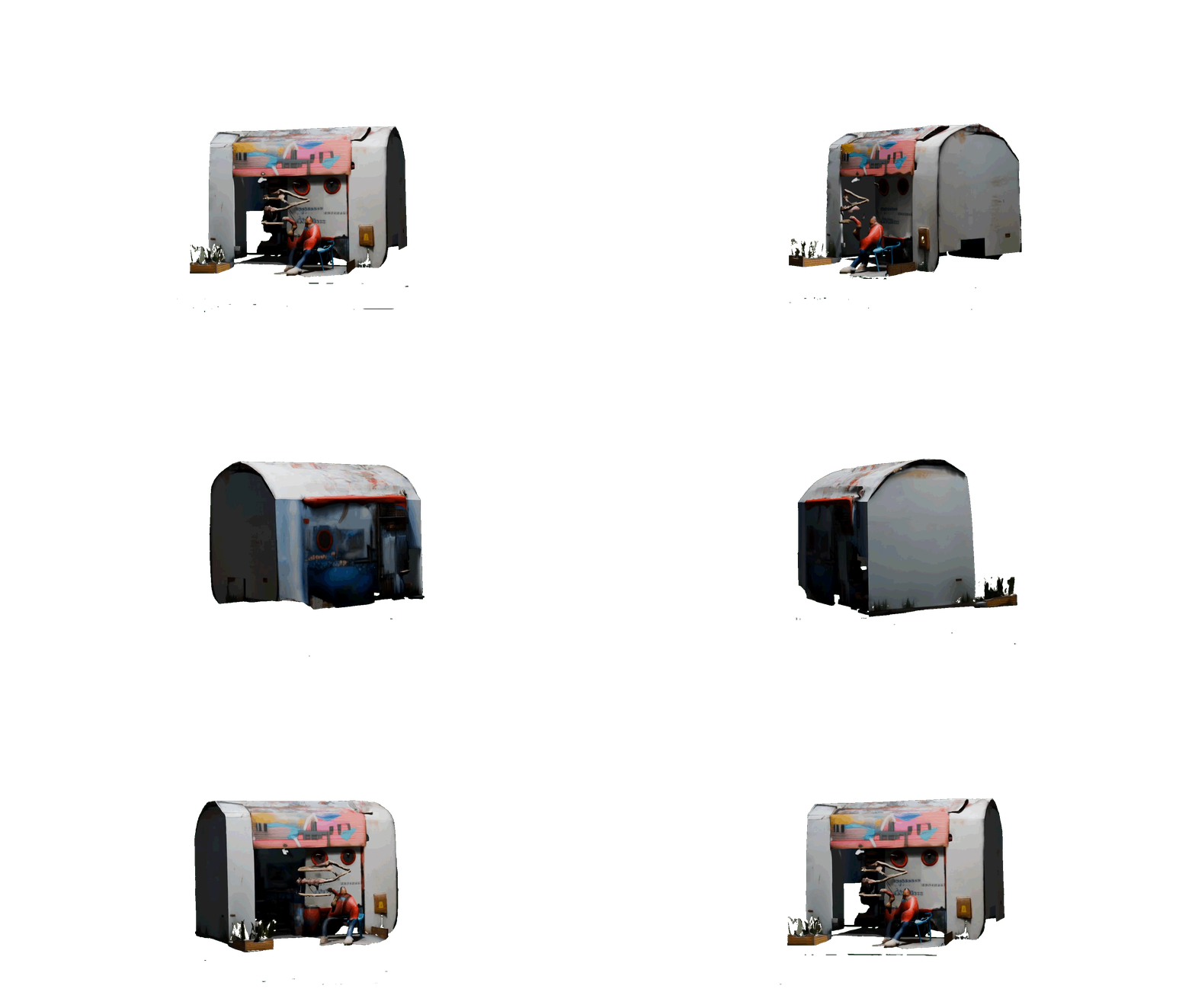
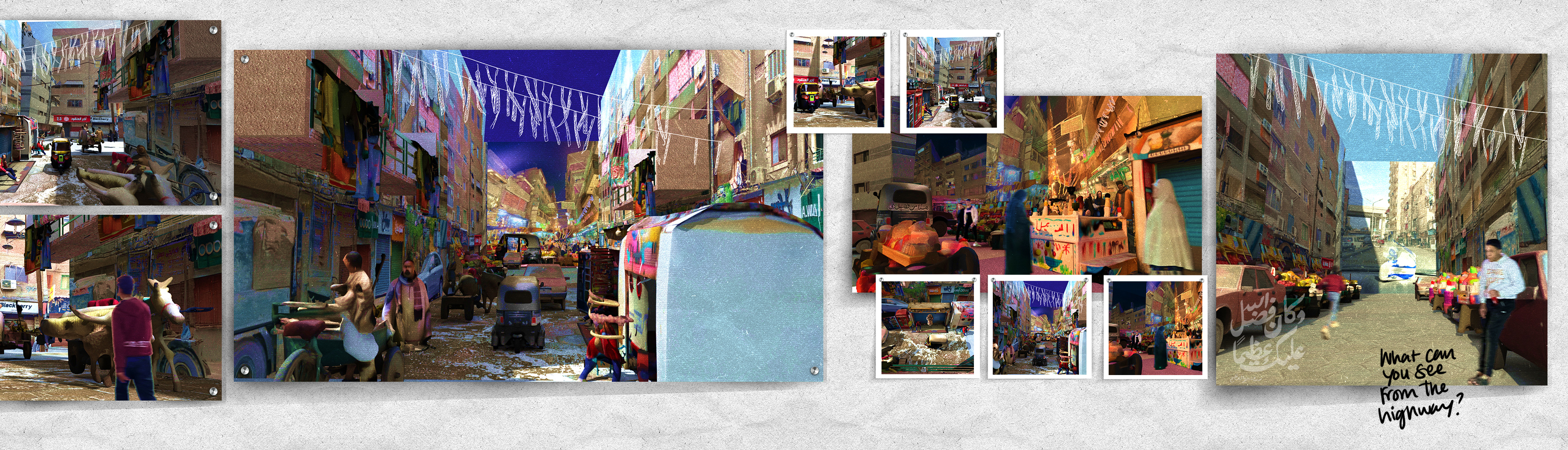
I primarily used PolyCam to develop patterns, adjust materials, and create 3D models using my photographs from Egypt to help me create my own digital world of Ard El-Liwa. Taking those key characteristics of Ard El-Liwa, I start setting up my scene in Rhino (as you can see on the board after the 2 rows of 3 square images) to develop images that I could not experience/photograph myself, to help me further understand and experience that informal culture and architecture.
...
[Beyond the images of my Rhino scene set up]
It is quite noticeable that the AI-generated 3D models, based on my own photographs, are missing a lot of detail, yet the essence and character are vividly captured, which is quite fascinating.
...
[The very last image on the board]
I wanted to end on this one image in particular that shows the streets of Ard El-Liwa empty during the day, for Ramadan, with the highway visible from a distance. It is a powerful collaged image that allowed me to reflect on the question I asked myself earlier in this journey: What can be seen and experienced beyond the highway, the one architectural element that separates these neighborhoods from the eyes of the world?
With the methodology I used, I was able to quickly document and represent those communities that are hidden by a political false narrative and a highway.
Key Takeaways from this process…
Cairene informal architecture isn’t a problem that needs eradication or displacement to a “better” place, as some people think. It is a type of architecture that needs understanding, embracing, and working with.
Cairene informal architecture might look haphazard and random at first glance, but the more you learn and experience, the more you understand that each piece added to the puzzle is intentional to develop that internal community and economy.
Rendering softwares are westernized. They generally have a clean aestheic that added to the misrepresentation of informal neighborhoods. Materials, objects, and assets from Enscape or Twinmotion are meant to produce a clean visual that lacks depth and history, unlike the materials I generated from pictures I gathered firsthand from Ard El-Liwa.
...
Overall..
This process was a fun way to voice communities and neighborhoods that need to be represented and seen.
This is not the end. It’s only the beginning of hopefully a better representation of these communities.
Huge thanks to CLUSTER (Cairo Lab for Urban Studies, Training and Environmental Research) for their immense help and involvement in enriching my thesis by providing great resources and helping me navigate Ard El Liwa in Cairo, Egypt.
Huge thanks to my thesis advisors Thom Moran and Adam Fure for all their support.